Maritime spatial planning
Mis à jour le 19/07/2024
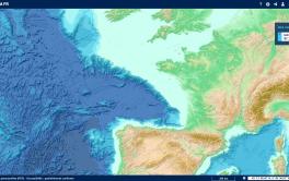
The Shom, a reference data provider for maritime spatial planning
The growth in the number of activities at sea (linked to historical and new uses) has resulted in an increase in the risk of conflicts between users in the sectors, as well as in anthropogenic pressure on marine ecosystems. The aim of the European Directive (Directive 2014/89/EU) on Maritime Spatial Planning (MSP) is to establish effective management of marine activities and sustainable use of coastal and maritime resources in a safe manner. Data is one of the key elements of MSP, which must be based on "the most reliable and up-to-date data possible".
France is responding to this directive with 4 strategic façade documents in mainland France and 4 in the overseas territories.
The Shom contributes to the development and review of planning by providing reference data on the physical marine environment, navigation safety aspects and maritime boundaries. It also produces expert reports and studies for marine renewable energy planning. Finally, it participates in stakeholder consultation bodies and in discussions on the dissemination of information to those involved in government action at sea.
")
The Shom, a European player in maritime spatial planning

Since 2015, the Shom has been involved in 10 projects co-financed by the European Fund for Maritime Affairs, Fisheries and Aquaculture (FEAMPA) on maritime spatial planning issues. The Shom's work has thus been carried out in various maritime basins in mainland France, with projects currently underway in the Baltic and North Seas, as well as an initial project in overseas France (French Guiana).
In European projects that bring together France and countries that share the same sea basins, it (i) develops transnational cooperation for MSP, (ii) operates geoportals for sharing information between States, via protocols that consume national reference data, and (iii) participates in the European Union's technical expertise group on maritime spatial planning data (TEG Data for MSP) to improve the interoperability of systems between Member States.